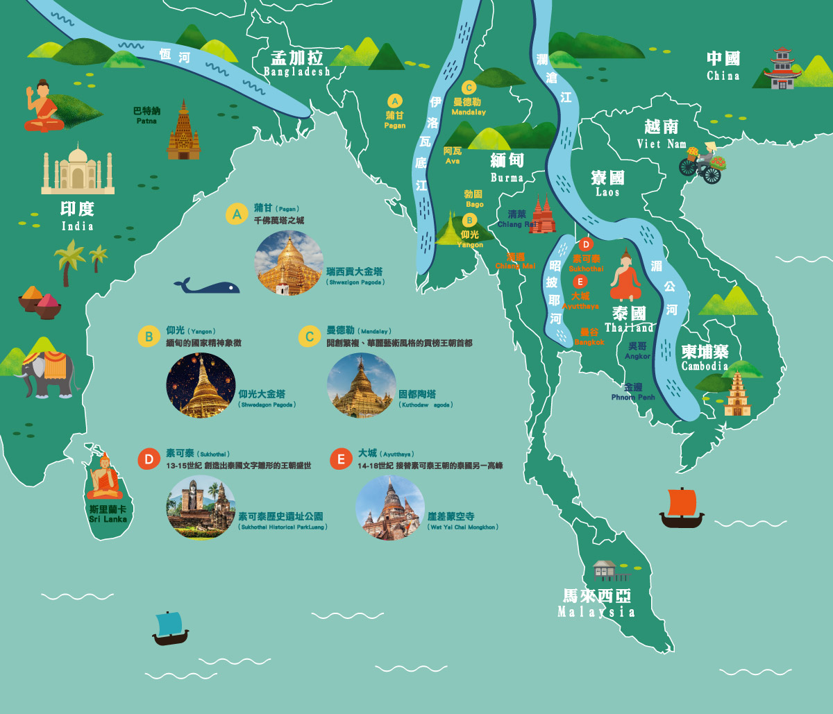
河流交織而成的南傳佛教文化地圖
緬甸、泰國、柬埔寨、寮國與越南所處的半島地區,地處於中、印兩大古文明之間,既是水陸交通要道,也成為多元文化相互激盪之地,政治、經濟、族群、社會、宗教信仰錯綜複雜,國土疆域的邊界隨著戰爭、王朝更替而不斷地游移。但深邃的河流不分國界、地界,包容了每一個生命與族群,人們傍水而居,建立家庭、聚落與帝國王朝,宗教信仰也在其中流轉、改變、融合。且讓我們跟隨著恆河、伊洛瓦底江、瀾滄江、湄公河與昭披耶河的流域地圖,探訪在此地流傳更迭的宗教文化與古國文明。
中文語音導覽
The cultural map of Theravada woven by rivers
The peninsula where Myanmar, Thailand, Cambodia, Laos, and Vietnam are located lies between two ancient civilizations, China and India, and it is a critical path for water and land transportation. Its critical location made it a place where diverse cultures inspired one another and one that exhibits complex politics, economics, ethnicities, societies, and religious beliefs. The borders of the countries have changed due to war and the passing of dynasties. However, the deep river is not affected by national borders or geographical boundaries, instead encompassing every life and ethnicity. People live by the water and establish families, tribes, and empires, and religious beliefs change, transform, and become integrated. Let us follow the basin maps of the Ganges, the Irrawaddy River, the Lancang River, the Mekong River, and the Chao Phraya River to visit the religious cultures and ancient cultures that have spread throughout this area.
English Audio Guide